
This artwork reimagines the QR code
as a three-dimensional city,
where information rises in the form
of architecture. A sculptural QR landscape unfolds like a dense metropolis, transforming digital code into urban structure.
What was once a functional pattern becomes a skyline — inviting viewers to see data not as something hidden, but as architecture we can enter, navigate, and experience.
כל צילומי הווידאו של תנועת המכוניות והאנשים נעשה בלילה באמצעות רחפן, מגובה מדויק וקבוע של 190מ׳, מה שהעניק את התחושה המדויקת של זווית המבט והפרספקטיבה בה יצפה הצופה ביצירה, כמי שמרחף מעל העיר.
המרחק והגובה אפשרו לתכנן טוב יותר את הפרופורציות, הקומפוזיציה, ואת מידת העוצמה החזותית שהעבודה תייצר.


בשלב הבא, כל ריבוע הומר לגוש תלת־ממדי והודפס במדפסת תלת מיימד בהתאם לערך הגובה שנקבע לו
כל יחידה נשמרה כקובץ עצמאי וכך נוצר מערך מלא של חלקים בנויים אשר הודבקו על משטח זכוכית שהונח על מסך מחשב ויצרו מעין עיר קומפקטית ודחוסה.
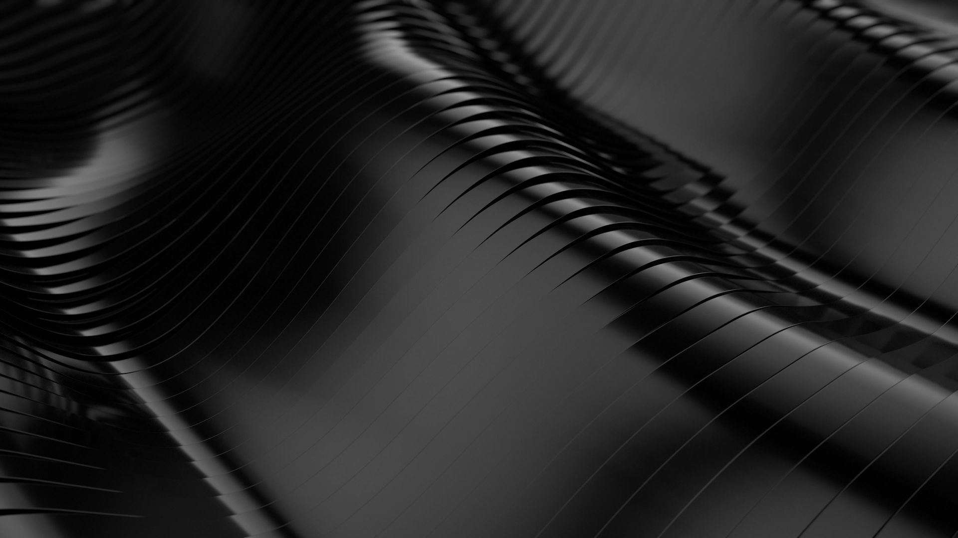
The first step was generating the QR code.
Once the code was created,
every single square (module) within it was mapped and assigned its own height in millimeters. Each square effectively became
a tiny vertical column. By translating the
flat QR pattern into varying heights,
the code transformed into
a three-dimensional landscape.
Seen from the side, the structure resembles
the silhouette of a dense city skyline rushing
toward you as you drive down a highway.
The squares were then grouped according to
their height values, creating a layered
topography derived entirely from the
geometry of the QR itself.
השלב הראשון היה יצירת קוד ה-QR.
לאחר יצירתו, כל ריבוע (מודול) במבנה הקוד מופה, והוגדר לו גובה מדויק במילימטרים. כל ריבוע הפך למעשה לעמודה אנכית זעירה. באמצעות תרגום הדפוס השטוח למִדרגי גבהים, הקוד החל להתהוות כנוף תלת־ממדי.
במבט מן הצד, המבנה מזכיר קו־רקיע צפוף — כעיר המאיצה לקראתך בזמן נסיעה בכביש מהיר.
בהמשך, ריבועי הקוד קובצו לפי ערכי הגובה שלהם, וכך נוצרה טופוגרפיה שכבתית — המבוססת כולה על הגאומטריה הפנימית של קוד ה-QR עצמו.
Next... Each square was turned into a 3D block,
raised to its specific height and saved
as its own 3D file, creating a full set of
buildable pieces. When everything comes
together, it will resemble a compact,
condensed city.

The Video
Shooting at nighttime, the traffic and people on the streets with a drone at a height of 190 m', gave me an accurate sense of the final viewing angle and perspective a person will have when looking at the artwork,
allowing me to plan its proportions better,
composition, and overall visual impact.
עריכת הוידאו של עשרות מקטעי הוידאו, נערכו, טופלו ונתפרו יחד באיזורים ״הלבנים״ של ה-QR בתוכנת DaVinci Resolve עד לקבלת המבנה החדש של
“עיר ה-QR” אשר תוקרן מאוחר יותר מתחת לקוביות הבנינים השחורות.
Finally, I combined all the edited videos created in the DaVinci Resolve app with the new structure of my QR City.
Each fragment of street footage was
taken separately and then assembled
together, forming a single condensed city
inside the inverted QR code,
where black and white are completely
reversed.
